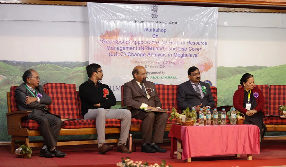
Workshop on “Geo-Spatial Applications for Natural Resource Management (NRM) held
A Workshop on “Geo-Spatial Applications for Natural Resource Management (NRM) and Land Use Land Cover (LULC) Change Analysis in Meghalaya” was held on Wednesday 13th March, at Don Bosco Youth Centre, Shillong.
The event saw the presence of Dr. S.P. Agarwal from the North Eastern Space Applications Centre, Government of India, Umiam as chief guest.
Various State and Central departments officials participated and delved into crucial topics including analyzing spatial and temporal changes in surface water area, linking geo-spatial data for urban sustainability, land use/land cover mapping, analyzing forest cover change in Meghalaya.
The other topics of discussion were on identification of prospective water harvesting sites in Ri-Bhoi district of Meghalaya, Spring Mapping in Meghalaya & Open Limestone Channel, GIS applications in bamboo resource assessment, use of space technology in mineral exploration, emerging tools & techniques and latest Satellite images, Development of State Geoportal and UAV Application for State Projects & Departments, Government of Meghalaya.
The day concluded with remarks from Prof. H J Syiemlieh, NEHU and Dr. S Ashutosh, IFS (Retd.), Co-Chairman & Director Centre of Excellence, MBDA.


Leave a Reply